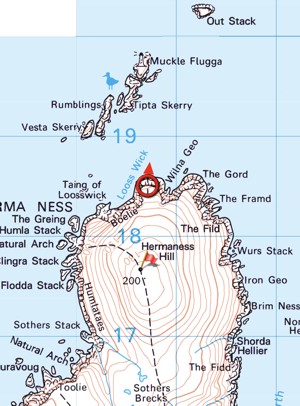
On Unst, Shetland - the most northerly point of any inhabited part of the UK. This is a National Nature Reserve. In late April the cliffs around the north westerly part of the route were teeming with puffins, gannets and other seabirds.
Park in the small car park at N60 50.682 W000 53.088. A visitor centre was being built here in April 2022.
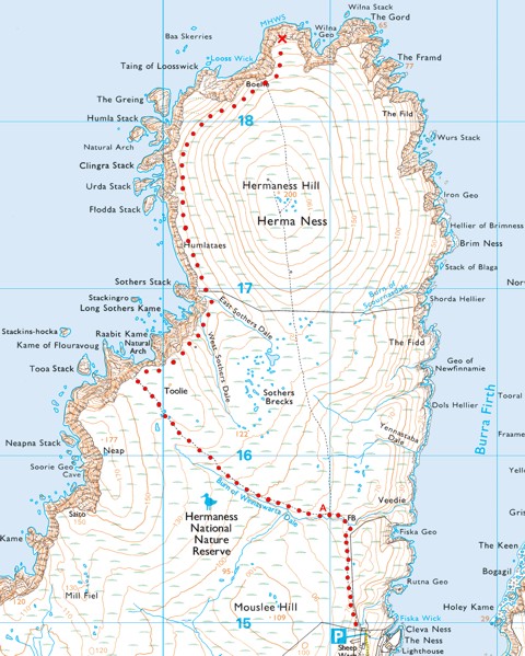
Take the track northwards to point A. The map shows a path going northwards over the top of Hermaness Hill, but this is now a closed off area so you should continue in a westerly direction. A wooden duckboard trail takes you all the way to the coast, at which point you turn right and follow the cliff top all the way round to the cache location. This westerly route is, in any case, the more scenic and interesting route.

This is a virtual cache, so there is no container to find.It should go without saying that you should only log a find if you have been to the location. Post a photo or screenshot of your phone or GPS screen. You can also, if you choose, include a photograph (taken by yourself) of the wildlife and/or the Muckle Flugga lighthouse.
A MemoryMap screenshot from my phone ...

This geocache description comes from the Opencache.UK site.
| Cache name | Hermaness |
| Gridsquare | JJ00AA00AA |
| Latitude | 0.000000 |
| Longitude | 0.000000 |
| Difficulty | Easy |
| Terrain | Handicapped accessible |
|
Empty
|
