
Description
Part 1 (General information about this cache)
- Target audience: Those who enjoy going for a longer walk and like multi caches where the cache is just a kind of virtual guide along the walk. This cache is about the walk and the scenery along the way (tumuli, old mills/homesteads, paddocks, meadows, forests, many wayside crosses and shrines, beautiful views to the surroundings) and about reflections about the past and future of the area (this aspect motivated the cache name, for more details see this note). Do not expect adventurous experiences and special hideout constructions. Do not come on a hot summer day and if possible choose a day which allows you to enjoy the view. The cache can be done in winter, however be prepared for digging for the final and for a DNF if there is much snow.
The cache has a similar set-up as my first multi cache around Kumberg and has been hidden out of the same main motivation. - Route and terrain information: Expect a walk of around 13-14 km with only moderate height changes which leads you along a mixture of forest trails, meadow trails, field tracks, gravel roads and paved roads (where they could not be avoided) in easy terrain (typically 1.5* or 2*). Depending on your walking speed and the length of your breaks expect to need 2.5-4.5 hours for this cache (runners will be faster).
The tour starts and ends near the church in Kumberg. The route combines the Kumberg hiking routes 1, 4 (only parts of it) and 5 with parts of the hiking route 768 and some non marked trails. The route has the form of a deformed eight and so you could split up the cache into two legs (the first is longer) both starting and ending at the provided parking coordinates if the whole tour is too long for you in one go.
- Mode of visit:
This cache has been set up with walkers in mind. Doing the cache by bicycle is possible in principle, but keep in mind that it is forbidden in many parts of the route. I urge you not to split up this cache into many parts by driving by motorized vehicles as close to the stages as possible. This is not the idea behind this cache. In any case, please respect all driving probihited signs (including those which allow driving for residents).
I ask you to visit this cache during day time and to refrain from visits in the dark. The (official) trails lead through private property several times (made possible by the kindness of the property owners) and pass by houses closely.
Be careful when you bring along dogs as paddocks with cows and horses are passed/crossed.
- Waypoint information: There are two waypoint categories.
- Stage waypoints: The waypoints for the virtual stages where questions have to be answered have prefixes S1, S2, etc in ascending order of their occurence along the route.
- Auxiliary waypoints: Auxiliary waypoints are referred to as H1, H2, ...., H9, HA, HB .... and are again numbered in increasing order with respect to their occurence. These points have been added to assist you in finding the right route (important for the additional tasks which are not associated with coordinates, for details see below) or to point out points of interest I did not want to turn into stages (the number of variables and stages should not become too high).
- Public transportation:
Kumberg can be reached by the Verbundlinie bus lines 200/201 and 220/221 . Get off at stop Kumberg Ganster (schedule)
Part 2 (Preparation at home)
Apart from classical virtual stages with given coordinates where easy questions have to be answered, this cache involves four additional tasks at unknown locations. To that end, you need to take along the following four photos Photo 1, Photo 2, Photo 3 and Photo 4.
None of the other photos in the gallery are needed.
Part 3 (Field work)
The field work splits into two parts. You need to visit 9 virtual stages along the way whose coordinates are given. In addition there are 4 additional tasks along the way (no coordinates provided - this is the sole reason for which I added the fields puzzle icon) - for details see below.
The stage info has been put into boxes. At your own risk you can ignore the route informations provided in between the stage info boxes. My goal has been to make it possible to go for this cache without a map of the area. Note however that sometimes the right route is not easy to find and moreover that it is important that you take the intended route along the paved segments and not your own in order not to miss the locations for the additional tasks.
I strongly recommend you to follow the suggested route to Stage 2 and further on to Stage 3 to avoid problems!
| Additional tasks along the way | No coordinates provided | |||||
Your task is to find the locations where I took the four additional task photos (the order of which is arbitrary and does not necessarily match the order of the occurence of the locations along the route). To make your task easier and to allow you to concentrate on the nature in the rural parts, I have limited the picture hunt to segments along paved roads and took all photos at or close to houses. (Moreover, the hint section provides a sanity check that might help you to realize that you missed a location.) In all cases your task is to write down a house number (only green signs need to be taken into consideration and only the number parts if letters are present too).
|
||||||
| Stage 0 Start | N 47° 09.547 E 015° 32.118 |
||||
From the parking coordinates walk to the start. Follow the main road (Hauptstrasse) until the auxiliary waypoint H1. Do not forget about the 4 additional tasks that wait for you in sections of the route along paved roads. |
|||||
Further way: (Auxiliary waypoints H1 and H2)
Turn right at waypoint H1. Follow the red-white-red marking until the end of the road to waypoint H2. From there take the small meadow trail down towards Stage 1.
| Stage 1: Bridge | N 47° 09.147 E 015° 32.408 |
||||
A nice small bridge.
|
|||||
Further way: (Auxiliary waypoints H3, H4, H5, H6, H7)
From the bridge take the trail that leads upwards into the forest and head for H3 (when in doubt take the right trail). At H3 turn left and follow trail 768 which will stay your companion for a while. Soon you leave the forest, follow the Waldweg (a road) up to the cross at H4. Now turn left into Wollsdorfstrasse that leads you down to the B72 road which you reach at waypoint H5 close to the former inn Bachwirt (worth to be looked at). Cross the B72 (be careful!) and follow the bicycle path until waypoint H6. There turn left into Eidexbergstrasse. Soon you can leave the road for a short episode in the forest by turning right, but will arrive back at the road before reaching H7. On your way you will pass a wayside cross with a bench where you can take a rest if you like.
At H7 turn right into the non marked small (municipial) trail which will lead you to Stage 2. The marked trail follows the paved road which I wanted to avoid. I urge you not use this trail in the darkness and not to ride a bicycle there (there are several houses and it's a dead end road that turns into a field and forest trail).
| Stage 2: Heart | N 47° 08.299 E 015° 32.146 |
||||
A declaration of love: Watch out for a tree with an encarved heart into which two letters (one above the other; separated by a + sign in the middle) are inscribed on the side pointing to the trail. (There is another heart on the back side which can be ignored; in case of doubt, take the smaller result for B).
|
|||||
Further way: (Auxiliary waypoints H8, H9)
Originally I had planned to follow the unmarked trail until it meets the paved road again. This is however not possible as a farmer blocked the trail near its end. I introduced Stage 3 to ensure that the cachers take the right way and no trespassing issues arise if cachers try to find their own route. Do not believe the maps!
At H8 take the trail upwards into the direction of H9. From there walk up to the road (Fasslstrasse). The farm area you traverse/pass belongs to the same family than the nearby inn Altes Fassl.
| Stage 3: Chapel | N 47° 07.969 E 015° 31.780 |
||||
You arrived at the Meinhart chapel. Close by you find the inn Altes Fassl which got established in 1841. Locals told me that due to the newly built large modern cow stable (owned by a relative of the inn owner) and other changes the number of visitors has declined considerably during the last years. Now focus back on the chapel. In the upper part of the black iron gate you will find a year date (4 digits separated into two groups).
|
|||||
Further way: (Auxiliary waypoints HA, HB)
Follow Fasslstrasse down to the B72 toward HA and cross the road with care. If you are hungry and like Chinese food, you can consider a visit to the inn Neues Fassl. In my childhood this inn has been a popular restaurant offering Austrian cuisine. I was recently told that the nearby (grocery) store Meinhart is endagered to get closed down. Times are changing .....
Fortunately, you can soon leave the B72 again. Turn left into the forest at HB and follow trail 1 towards Stage 4.
| Stage 4: Signpost | N 47° 08.744 E 015° 31.701 |
||||
A signpost with two arrow-shaped signs.
|
|||||
Further way: (Auxiliary waypoint HC)
The route is well marked in this section. Follow trail 1 further on to HC (there take the left trail) and further on to Stage 5.
| Stage 5: Wayside Cross | N 47° 08.989 E 015° 31.821 |
||||
You arrived at a wayside cross close to a former old mill (Kreuzmühle). Watch out for a year date which is inscribed into the wooden part of the cross.
|
|||||
Further way:
Continue to follow trail 1. Shortly before Stage 6 leave the paved road and enter the forest. Continue to Stage 6. I included that stage despite its closeness to the preceding stage as I wanted to attract attention to the tumuli which could easily be missed otherwise.
| Stage 6: Tumuli | N 47° 09.162 E 015° 31.821 |
||||
In this part of the Regner forest there are several tumuli. (Years ago there has been a cache dedicated to tumuli in Kumberg but I cannot recall whether the cache showed the same tumuli or others in the same forest). The coordinates point to one tumulus (there is a huge hole on the top). What can you find at this location (within a small radius)?
|
|||||
Further way: (Auxiliary waypoints: HD, HE, HF, HG )
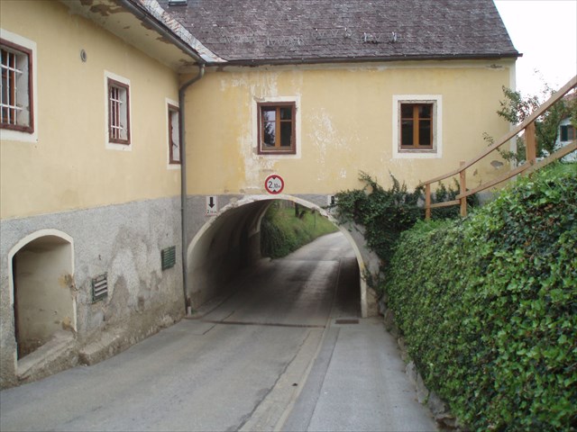
Soon after the tumuli you will reach the road again. Note the wayside shrine and the dog station (English term used on the object - terrible mix of languages!) at HD. Now follow the trail down the meadow into the forest again. After a short forest episode you will reach the Schmiedgraben road at HE. Now follow the road until a the cross at HF. If you look uphill you will see an archway where the road leads through. The buildings belonged to the former inn Schmied (with an enclosed bowling alley), one of several buildings/objects in Kumberg which are under monumental protection.
Turn left at the cross and follow from now on (until Stage 9) trail 5 (to Hofmühle). After a short section along a small dead-end (paved) road you end up in a pretty private looking area (meadow, garden). Do not worry - the official hiking trail leads through there. If you look carefully, you can already see the next sign post at HG. There turn right and follow the trail down the meadow towards Stage 7.
| Stage 7: Another bridge | N 47° 09.482 E 015° 31.645 |
||||
You arrived at another bridge. What can you find here?
|
|||||
Further way: (Auxiliary waypoints HH, HI)
Walk over the bridge and continue on the meadow trail. You will now cross a paddock with horses (two at the time of my visit which both were harmless and friendly and did not care about me). There is a gate (close it properly after your passage) at the entrance to the paddock and a sqeeze stile at the exit.
Follow trail 5 further into the direction of HH until you end up in the village Rabnitz close to the equipment depot of the fire brigade. Turn left into the paved road. After having passed the wayside shrine turn right into Dorfstrasse (dead-end street). Soon you will pass the must tavern Hiebler (open March-October, Fr, Sa and Su from 2pm onwards) on the left side of the road at HI.
If the weather permits you will have a nice view to the castle Kainberg and to Kumberg along your way. After a while the paved road ends. If you are tired, you can have a rest at the bench there. Take the right trail (gravel trail) towards Stage 8.
| Stage 8: View point | N 47° 09.784 E 015° 30.971 |
||||
Time for a short break? What can you see here (close by and not in a larger distance)?
|
|||||
Further way: (Auxiliary waypoint HJ)
After a short episode on a gravel road section a nice forest area section waits for you. Take the right trail at HJ.
On your way to Stage 9 along the Rabnitz (passing impressive ferns and old trees) you can pay a visit to the cache Freundschaft.
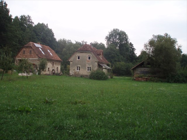
| Stage 9: An old mill | N 47° 10.251 E 015° 31.267 |
||||
You arrived at the last intermediary stage, another old mill/homestead (Hofmühle). Watch out for a wooden pole with three signs: two red-white-red hiking signs and a third one with two words in white on green background.)
|
|||||
| Final | N 47° P.Q E 015° R.S |
||||
Now you are almost done. It remains to undertake the easy calculations given below. Alternatively, you can use make use of the multichecker if you have mobile internet access. (The multichecker option is an experiment - if it gets abused, I will remove this option.)
The cache container is a small lock and lock container and is hidden at a characteristic hideout. I searched for quite some time for a suitable hideout that can be reasonably reached in all seasons. I will give it a try without a spoiler photograph in order to reduce the risk for brute force attacks (stage skipping). |
|||||
Further way: (Auxiliary waypoints HK, HL)
Trail 4 will lead you back to the parking location. The waypoints should be sufficient also for those without map.
Deutsche Beschreibung:
© cezanne, Opencaching.de, CC-BY-NC-ND; all log entries © their authors
Photos
Information
| Cache name | An eight around Kumberg: Past, present, future? |
| Hint | [Additional task II:] ivy, decorative green door [Additional task IV]: rose [A litte help for the |
| Country | Austria |
| Gridsquare | JJ00AA00AA |
| Latitude | 0.000000 |
| Longitude | 0.000000 |
| Difficulty | Easy |
| Terrain | Handicapped accessible |
Logger
|
Empty
|
Rate
Recommend
